The flood gauge and Højer Lock
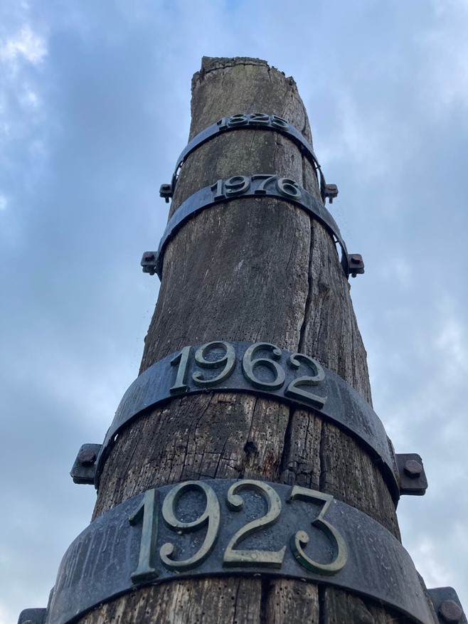
Højer Lock was built in 1861 together with a longer dike. The dyke and the sluice prevented high water levels in the North Sea from propagating up into Højer Canal and Vidå, as well as flooding the low-lying marshland near Højer.
The lock was normally open, but during storm surges, the lock was closed. You can see the impressive old lock and enjoy a walk on the old dike, where you can look out over the marshland landscape in all directions as far as the eye can see.
Today, the lock is no longer in operation, but has been replaced by the Vidå Lock, which is located a little further out towards the North Sea.
At Højer Lock, you will find the storm surge gauge that shows how high the water reached in 1923, 1962, 1976, and 1825 in that order. The flood in 1976 led to an increase in the protection in the area. In 1981, the Vidå sluice and the associated dike were positioned further out towards the North Sea.
You can read more about how the flood of 1825 affected the area near Højer here: https://www.mitvadehav.dk/sites/mitvadehav.dk/files/faktaark_stormflodssoejle_hoejer_gamle_sluse_0.pdf
There is a parking lot at Højer Lock.
.



Slusevej 25, Højer, Denmark