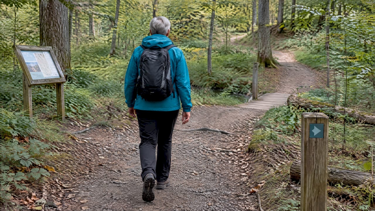
Hiking trails connect nature and create access, health benefits, and economic value for local communities. They function as physical infrastructure that safely guides visitors through the landscape, while supporting public health and strengthening tourism in the areas they cross. In the following, we look at how the routes work in practice, who operates them, and what you can do yourself to plan a good trip.
What do hiking trails actually do for the landscape and the user?
A hiking trail is more than a mark in the terrain. It functions as infrastructure with clear start and end points, signage, and information boards that make it possible to navigate without local knowledge.
The channels also have a guiding function. By guiding visitors along well-defined paths, they protect vulnerable natural habitats from wear and tear while providing access to experiences that would otherwise be difficult to find. It applies to forest trails, coastal stretches, and the longer national routes.
The mediation is the third pillar. Signage, route descriptions, and digital maps make it easier to plan the trip and safer to carry out.
- Physical markings and signage help you follow the route without getting lost.
- Channeling traffic protects nature and reduces conflicts with wildlife and landowners.
- Digital maps and route descriptions provide an overview before and during the trip.
Advantages of hiking trails: health, settlement, and tourism
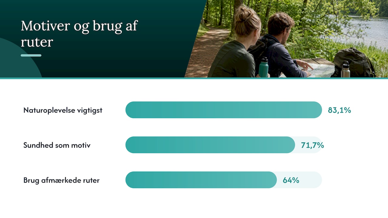
The nature experience is the strongest driving force behind hiking. indicates in a survey 83.1% of respondents consider the experience of nature to be the most important motivationMen, 71.7% highlight health as a central reason for going out for a walk. In Denmark 64% of the population used marked trails and routes as an integral part of their outdoor life, which shows how crucial the recreational infrastructure is for Danes' everyday life.
The socio-economic impact of outdoor life in Denmark is estimated to be around 30 billion kroner and nearly 30,000 jobs.according to the publications of the Outdoor Council on the values of outdoor life. The figure covers everything from equipment and accommodation to local trade in the areas the routes pass through.
For municipalities and destinations, it means that a well-maintained route can extend the season and attract visitors to areas that would otherwise not be at the top of the tourist list. The health effect and the economic gain are thus interconnected: the easier it is to get out, the more people use nature, and the more value it creates locally. You can read more about these contexts in our Guide to the benefits of nature experiences in Denmark.
Who plans the routes, and how are they financed?
Behind every hiking trail lies a collaboration between several actors. The municipalities are often responsible for local operations, while state and voluntary organizations contribute with advice, standards, and funding.
- Municipalities build and maintain local sections, often in dialogue with landowners.
- The Danish Nature Agency manages state land and participates in establishing connected routes such as Denmark's Nature Trails.
- The Outdoor Council advises and allocates funds for the development of trails and recreational infrastructure.
- Foundations and associations often contribute supplementary funding to larger construction projects.
Establishing long, continuous routes requires complex partnerships between authorities, funds, and landowners, and financing as well as coordination are typically the biggest barriers to realizing the projects, as outlined in the Danish Nature Agency's work with pilot projects. Inter-municipal coordination is especially important when a route crosses multiple municipal borders, because operation and maintenance can easily fall between two stools.
Facilities and maintenance: what makes a route usable and safe?
A route lives or dies by its facilities. Without signage, water posts, and rest areas, even a beautiful stretch becomes difficult for ordinary users to traverse.
- Clear signage at intersections and important points prevents you from getting lost along the way.
- Broes and paths over wet or uneven sections ensure accessibility all year round.
- Vandal posters and shelters provide opportunities for breaks and overnight stays on longer trips.
- Seating areas and rest stops make the route accessible for children, the elderly, and less experienced hikers.
Maintenance is often crucial for whether a trip can even be completed and for safety along the way, especially for families and inexperienced users, as pointed out by the Outdoor Council's publications. A damaged bridge or a dry water post can practically close an entire route for the most vulnerable user groups.
Professional tip: Always check the latest status update of the route or the municipality's website before planning a longer trip, as temporary closures are rarely shown on older maps.
How to find and prepare for your hiking trip
Start with official sources such as municipal websites, the Nature Agency, and local tourist organizations, which often have updated route descriptions. Supplement with apps and digital cards that show current status and severity.
- Use official maps and route descriptions as the first choice instead of older printed brochures.
- Check the weather forecast and transportation options to and from the starting point before finalizing the route.
- Follow the physical markings on shorter, well-marked routes, and use GPS as a supplement on longer or less marked sections.
- Bring water, a map of emergency exits, and leave nature as you found it.
Studies show a mixed use of digital and analog sources among hikers, and 58% believe that signage remains indispensable Even in an era with GPS and apps. It confirms that good physical marking is still the backbone of a safe trip.
Examples from Denmark and current projects
Denmark has several longer routes that demonstrate what systematic planning can create, from coastlines to forest routes with shelters and rest areas along the way.
- The West Coast Trail and similar long routes illustrate how continuous stretches can connect the coast and nature across multiple municipalities.
- Vanuatu It is a cross-municipal project between Næstved and Faxe with grant support and test sections from 2023 to 2026.
- The project concretely demonstrates how municipalities, funds, and local actors can collaborate to create a route that crosses administrative boundaries.
You will find more specific route suggestions in our Overview of examples of hiking trails in Denmark.
Our resources: how Rejs i Danmark helps your planning
We collect experiences and nature destinations on an interactive map with filters, so you can quickly get an overview of options in an area. The guides describe many places and activities with practical details that make it easier to plan a trip.
You can use these tools to find nature experiences near a planned route or to supplement the trip with other activities along the way. For example, our Overview of nature experiences in Denmark as a practical starting point.
What does it take to further develop hiking trails in Denmark?
The greatest benefit moving forward lies in better coordination across municipal borders rather than more isolated trail systems. Many routes effectively end where a municipality stops, even though nature and the hiker do not.
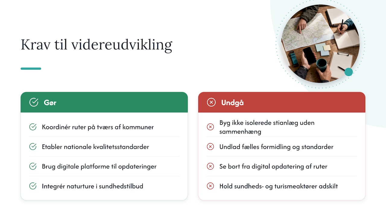
National dissemination and common quality standards can make it easier for visitors to choose and trust a route, regardless of where it is located in the country. Digital platforms should play a greater role as a link between physical signage and updated information about closures or weather conditions.
The most overlooked opportunity is the interaction between the healthcare sector and tourism: nature-based tours can be used more consciously as a practical health service, not just as a leisure activity. It requires dialogue between municipalities, associations, and tourism operators, who often work separately today.
— Tommy
Bridge Travel in Denmark to find your next route
We make it easier to go from idea to actual trip by gathering nature experiences, attractions, and practical details in one place, so you don't have to search across a handful of different websites.
- Use our interactive map to find experiences near your planned route.
- Filter by season and participant age so that the trip suits the whole family.
- Check our Guide to planning a trip to Denmark as a starting point for a longer trip with several stops.
Frequently Asked Questions
What is the purpose of hiking trails in Denmark?
Hiking trails provide structured access to nature through markings, signage, and facilities, while also channeling traffic away from vulnerable areas. They support both public health and local tourism, as shown by the Outdoor Council's figures on Danes' use of marked trails.
Who is responsible for maintaining hiking trails?
The responsibility typically lies with the municipalities for local stretches and with the Nature Agency for state-owned areas, often in cooperation with the Outdoor Council and local associations. Funding also comes from foundations, as seen in the Vandrelandet Selandia project.
What economic significance do hiking trails have for local communities?
Outdoor life in Denmark has a socio-economic impact of around 30 billion kroner and creates nearly 30,000 jobs, according to publications by the Danish Outdoor Council. Good routes can extend the tourist season and attract visitors to lesser-known areas.
How do I find reliable information about a hiking trail before I go?
Start with the municipality's website or the Danish Nature Agency's overviews, as they often have the most up-to-date descriptions of the route's condition. Bring digital maps and local guides, and always check the weather and any temporary closures before departure.
Why is signage still important when most people use GPS?
Studies show that 58% of hikers still consider physical signage indispensable, even in an era of widespread app usage. Signage functions as a reliable backstop when GPS signal or battery fails along the way.
Sources
- Hiking and terrains – DI tourism research
- The Outdoor Council – Trails, routes, and recreational infrastructure
- BTE Travel Study 2024 – media and route preferences
- Næstved Municipality – press release about Waterland Selandia